-
4,965 metres
-
Manizales (or Pereira)
-
4x4 vehicle
-
Mountain Chalet
-
Year round
-
English, Spanish
-
National Parks Endorsment
-
All meals during the expedition
-
Personalized
-
16
-
69
Overview
Witness one of Colombia’s last tropical glaciers — before it vanishes forever.
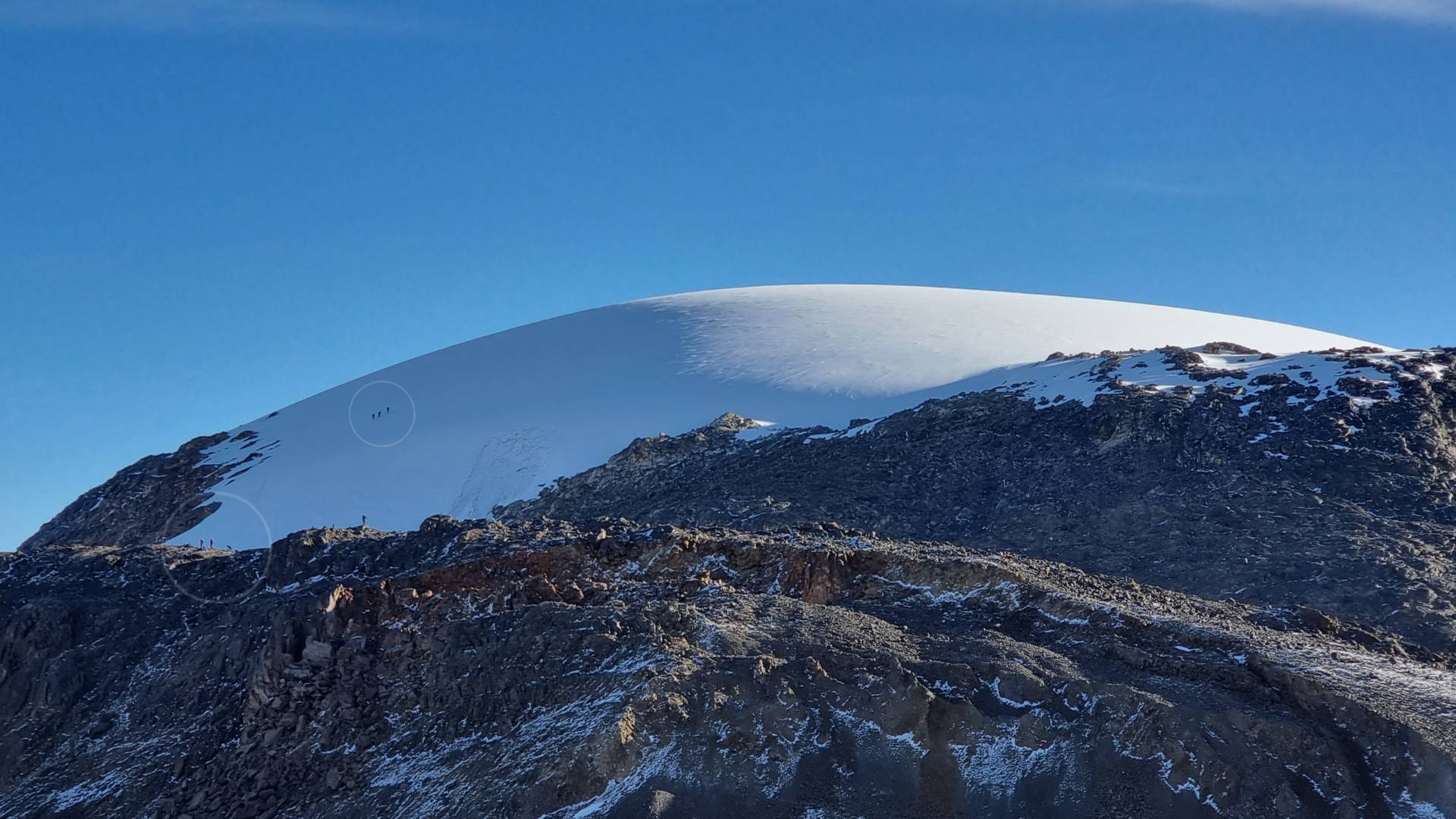
The Nevado de Santa Isabel, known as Poleka Kasue — “Princess of the Snow” in the ancestral Quimbaya language — is Colombia’s most rapidly retreating glaciated peak. Sitting at 4965 metres above sea level in the Central Andes, rising above a landscape of ancient páramo and volcanic moraine that few people ever reach.
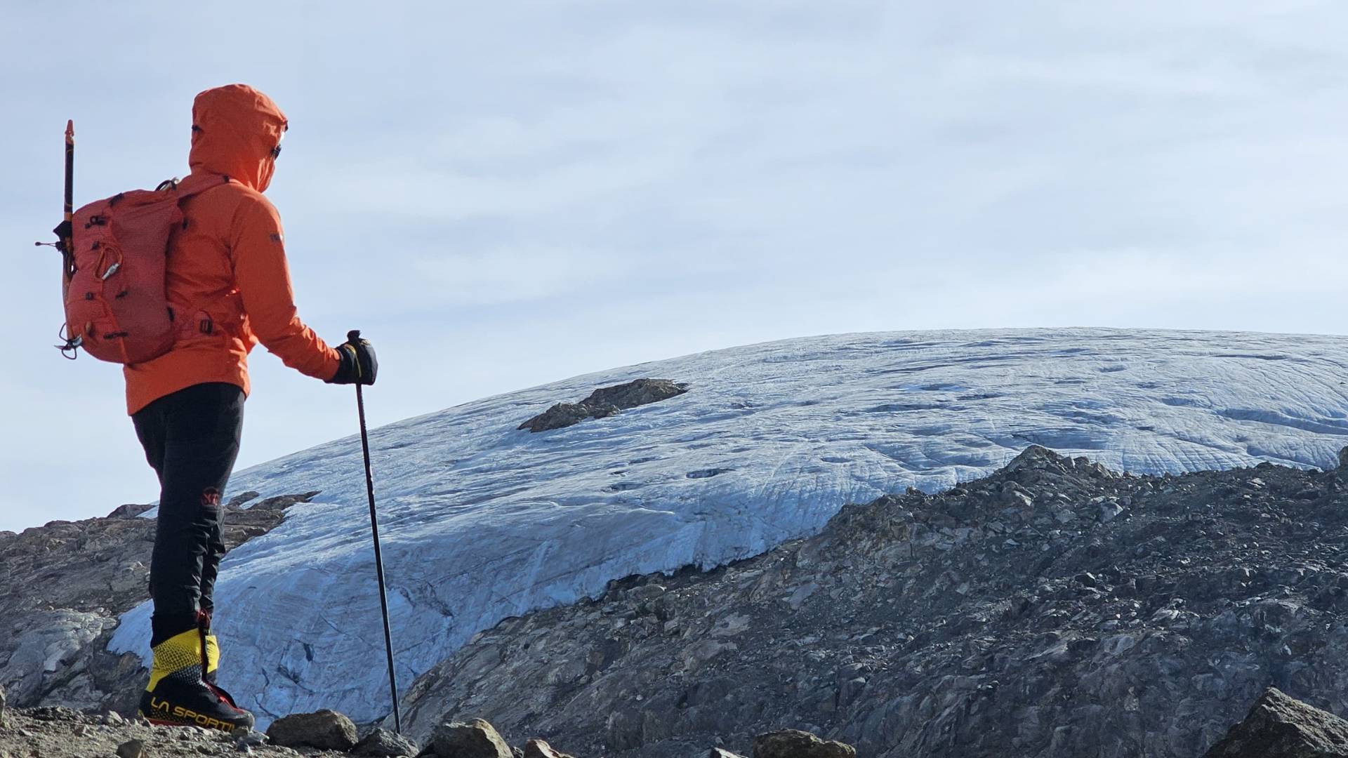
What makes this expedition unlike any other is the window of time. Colombia’s meteorological institute, IDEAM, has documented one of the fastest rates of glacial retreat ever recorded at equatorial latitudes. Between 2016 and 2018 alone, it lost 37% of its surface area — a rate described by researchers as unprecedented at a global scale. The central summit, once accessible via the Conejeras trail, lost its glacier entirely by 2024. Today, only the north summit still holds ice. Scientists estimate it could disappear completely by 2030. This is not a scare tactic. It is context. Climbing Nevado de Santa Isabel right now is one of the most meaningful experiences available in Colombia — part expedition, part living classroom, part act of witness.
Our 2-day route is designed for physically fit adventurers with no prior mountaineering experience required. For those pursuing high-altitude mountaineering in Colombia, Santa Isabel is the ideal starting point — technically accessible, genuinely challenging, and set inside Los Nevados Park.
Highlights
- Summit Colombia's most accessible Nevado (4965m).
- Witness a unique tropical glacier — before it vanishes forever.
- Full acclimatization day with a hike to the emerald-like laggon "Laguna Verde" (4450m).
- Confortable refuge — "El Cisne" the highest hotel in Colombia (4000m).
Itinerary
Mountain Approach
Your expedition starts before sunrise with pickup from your accommodation in town or a nearby access point along the Nevados corridor (approximately 5:00–6:00 AM, confirmed after booking).
The adventure begins with an approximately 3.5-hour 4x4 off-road ascent into Colombia's Central Andes. After a traditional Colombian breakfast along the route, the landscape gradually transforms from humid cloud forest to high-altitude farmland before opening into the spectacular páramo.
At the entrance to Los Nevados National Natural Park, park rangers complete registration, ID verification, and environmental and safety briefing. From here, the journey continues to the Laguna Verde trailhead (4,200 m), where you'll prepare your daypack and leave non-essential gear safely in the vehicle.
Laguna Verde Acclimatization Hike
Duration: ~3 hours round trip | Distance: 4.5 km | Maximum altitude: 4,450 m
Your first hike is a gradual acclimatization trek to Laguna Verde, a beautiful glacial lagoon surrounded by volcanic landscapes and towering frailejones.
The trail crosses the unique páramo ecosystem, where rapidly changing mountain weather often reveals dramatic views of the Nevados. Depending on the light, the lagoon shifts between deep emerald and turquoise, creating one of the most peaceful landscapes in the park.
El Cisne Mountain Refuge
After the hike, you'll arrive at Refugio El Cisne, your base for the evening.
Facilities include: Shared dormitory accommodation, hot showers, limited WiFi, restaurant.
Lunch is served upon arrival, followed by a technical briefing covering:
- Glacier travel techniques, rope systems and safety procedures
- Crampon and ice axe use
- Altitude & risk awareness
- Summit preparation
The rest of the afternoon is reserved for rest, hydration, and acclimatization.
Dinner is served early before everyone gets a few hours of sleep. Passed midnight, your guide will wake the group to begin preparations for summit attempt.
Passed midnight, your guide will wake the group for the summit push. The exact departure time is determined by weather conditions and the pace of the group.
Before setting off, everyone gathers in the refuge dining room for a hot drink, a light snack, and a packed breakfast. Grab your summit daypack and collect all personal belongings (to be left in the vehicle), as we will not return to the refuge after the climb.
A short 30-minute drive takes us to the Conejeras (Climate Change) Trailhead, where the ascent begins under the stars.
Nevado Santa Isabel Summit Ascent
Duration: Approximately 7–9 hours round trip (depending on conditions and group pace)
Distance: 10 km
Minimum altitude: 4100m | Maximun altitude: 4965m | Elevation Gain: 865m
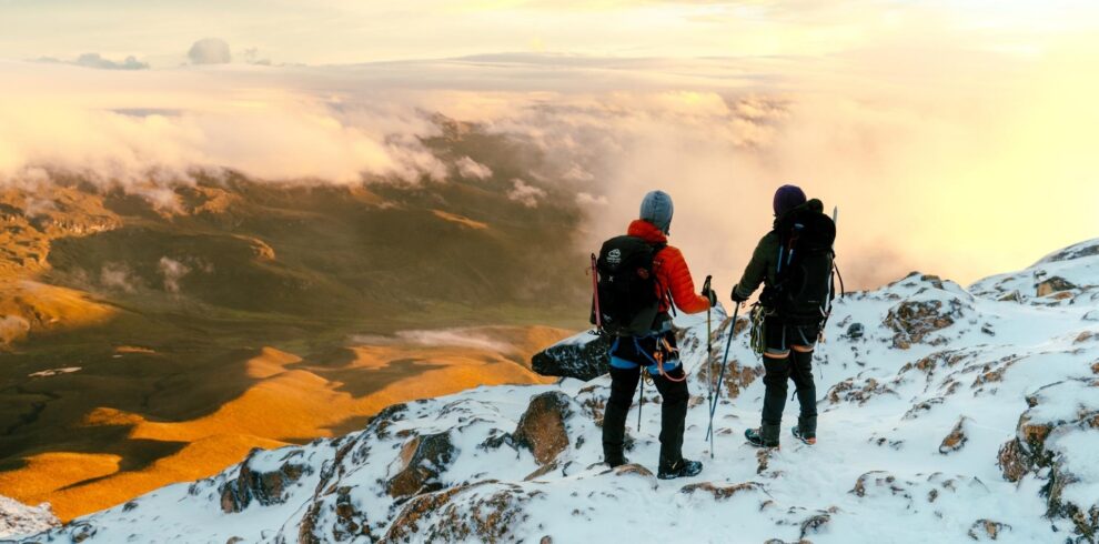
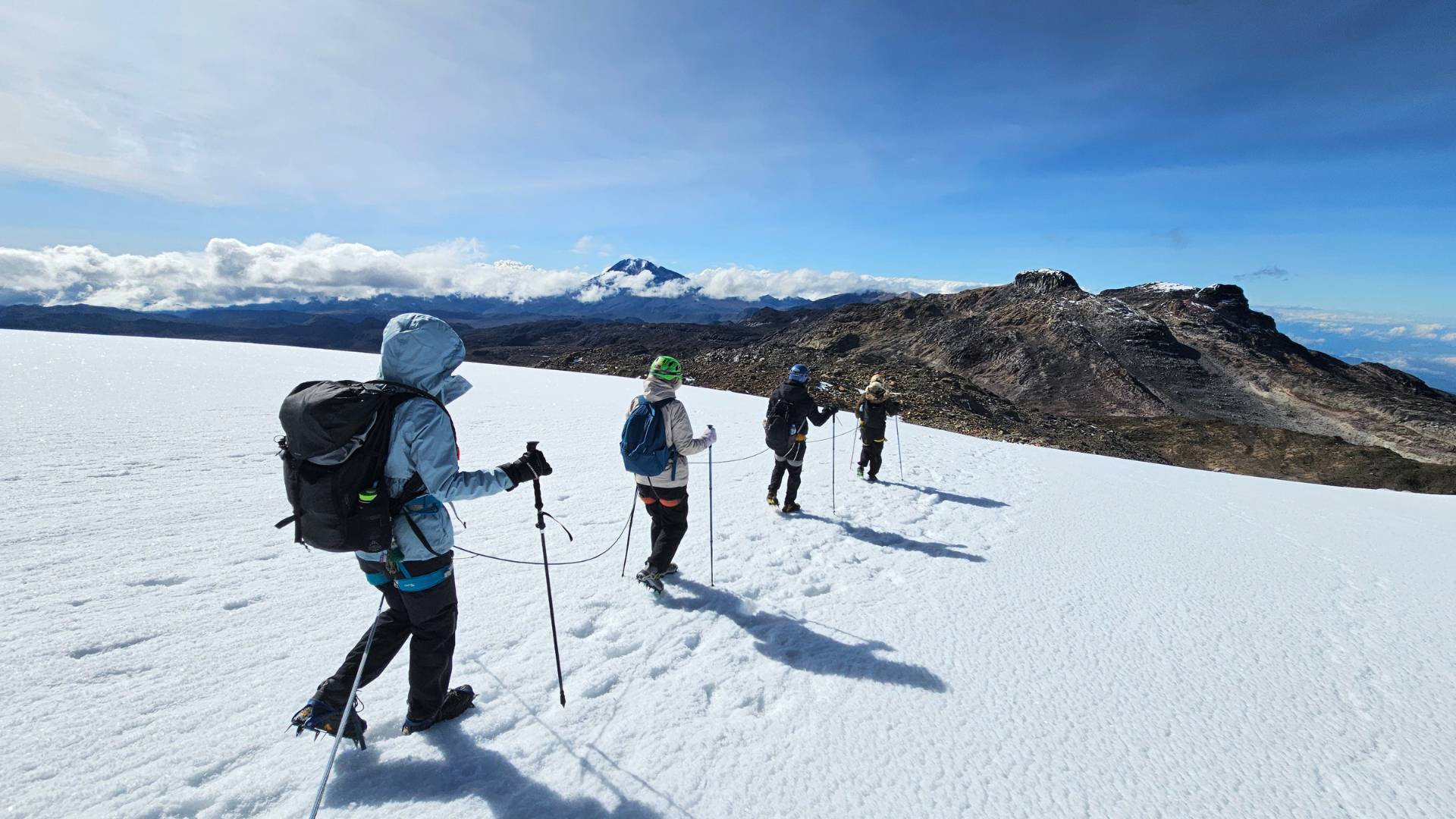
The trail gradually climbs across the high-altitude páramo and glacial moraine before reaching the edge of the glacier. After fitting crampons and receiving final instructions, we rope up and continue across the ice as dawn begins to illuminate the surrounding peaks.
As the sun rises over the Central Andes, the glacier reveals an unforgettable landscape unlike anywhere else in Colombia.
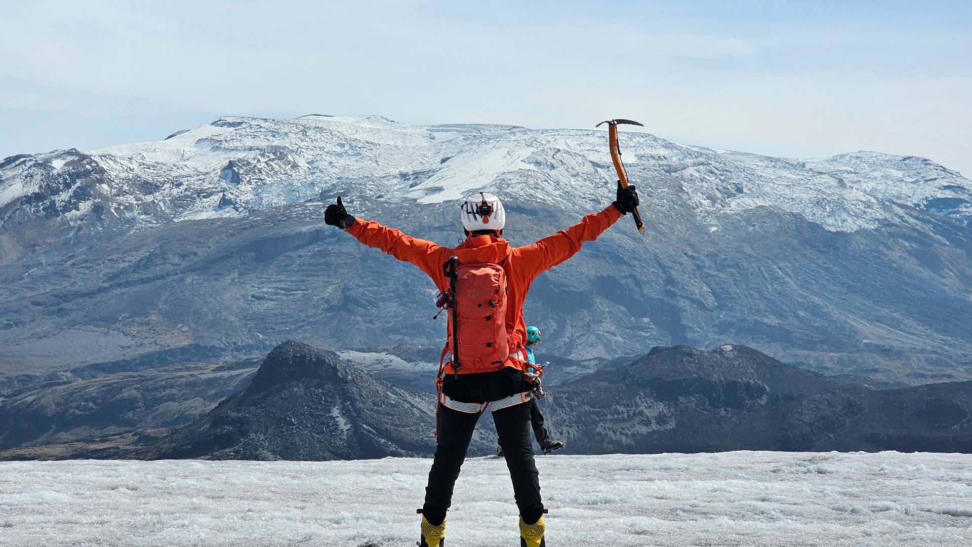
Reaching the summit is the highlight of the expedition. Weather permitting, panoramic views extend across much of Colombia's Central Andes, including Nevado del Ruiz, Nevado del Tolima, Paramillo de Santa Rosa, the city of Manizales, and the Western Cordillera.
After a short time at the summit for photographs and celebration, we descend carefully along the same route back to the trailhead.
Return Journey
Back at the vehicle, there's time to relax and enjoy a well-earned rest as we descend from the mountains. A stop is made along the way for lunch before continuing the drive back to the city. Under normal conditions, arrival is expected at approximately 5:00 PM, marking the end of an unforgettable two-day high-altitude expedition in Los Nevados National Natural Park.
Details
What’s Included
- Pre-Expedition Guidance: Online Q&A sessions, plus personalized advice to help you prepare for the challenge.
- National Park Entry: Reservation and entry permit to Los Nevados National Natural Park.
- Professional Guide: Experienced expedition guide specialized in mountaineering, wilderness first aid, and environmental interpretation (fully licensed). Bilingual available.
- Mini Mountaineering Course: Learn essential trekking and glacier techniques, along with environmental education throughout the expedition.
- Technical Gear: Helmet, harness, rope, crampons and trekking poles.
- Meals: Full board during the expedition, plus eco-snacks.
- Accomodation: Night at El Cisne refuge
- Insurance: Comprehensive travel insurance (Colasistencia – PNN approved).
- 4x4 Vehicle: Round-trip.
- Memories: Expedition photos and a souvenir.
Add-Ons & Optional Services
- Additional LOCOMBIA Experiences: Extend your trip with a coffee tour, acclimatization hike, and more before or after your expedition — or take it further and explore Colombia’s more remote regions, such as Guainía and beyond. 👉 Explore all our Experiences & Destinations
- Accommodation (Before & After): Recommended places to stay in Manizales before and after your expedition. 👉 Check out the expedition FAQ's section for more info.
- Private Transfers: Transport from the location of your choice to Manizales (enquire to check availability).
- Medical Consultation: For added peace of mind, consult with one of our specialist doctors before your expedition. We work with professionals in mountain medicine, sports medicine, and travel health to assess your readiness for high-altitude and remote environments.
Price & FAQs
Price depends on group size
Starting at COP $1.450.000
For safety and quality, we maintain a low guide-to-client ratio. Typically, one guide is assigned for every 4-5 participants. As group size increases, an additional guide and vehicle may be required — which can slightly affect the price per person.
You can choose to book a private expedition on your preferred dates, or join a group with like-minded travellers on fixed group dates.
Final Pricing (per person)
Group Size | Price (COP) | Notes
1 person $0.000.00 Private expedition
2 people $0.000.00 Private expedition
3 people $2.500.000 Private expedition
4-5 people $1.450.000 Best value 
6+ people On request Bespoke
Book your spot with just a 30% deposit | Secure international card payments accepted
Plan Your Expedition On Whatsapp
Limited spots available due to National Parks daily capacity restrictions. We recommend booking in advance to secure your preferred dates.
No prior mountaineering or technical climbing experience is required. During the expedition, our guides will provide a basic introduction to glacier travel and the use of technical equipment such as crampons, ice axe, and ropes when necessary.
That said, this is a physically demanding high-altitude expedition and should not be underestimated. Participants should be in good physical condition and comfortable hiking for multiple hours per day, often with significant elevation gain and changing weather and terrain conditions.
Difficulty Level: 4/5 – Challenging
This expedition is suitable for fit and well-prepared hikers seeking their first high-altitude mountaineering experience, as well as experienced trekkers looking for a rewarding Andean mountaineering trip.
Don’t worry — we’ve got you covered so you can travel light and avoid complex logistics. We provide all technical equipment.
You only need to bring your personal clothing, trekking boots, accessories, toiletries and backpack.
👉 Download the full gear checklist
If you’re missing anything, we can assist with gear rental.
👉 Explore our blog for practical tips, insights, and stories from the field
Summit success depends on many variables, including weather conditions, acclimatization, and individual physical and mental condition. While we can’t guarantee a summit, our expeditions are designed to maximize your chances through proper acclimatization, pacing, logistics, and decision-making in the field.
Based on our experience, the typical summit success rate is around 85%, depending on conditions and participant preparation.
Safety is always the priority. If weather or mountain conditions are not suitable for a safe summit attempt, the guide will make the decision to adjust the plan.
This may include delaying the summit push, modifying the route, or turning back if necessary. While this can be disappointing, these decisions are essential to ensure the safety of the group.
Temperatures at high altitude can drop significantly, especially during summit attempts. Having the correct clothing is essential for your safety and comfort.
As mountain conditions are outside of our control, changes to the itinerary or summit outcome do not qualify for refunds.
At high altitude, it’s normal for some participants to experience fatigue or altitude-related symptoms — even very fit individuals.
For safety reasons, the group typically moves together, especially when there is a single guide. In some cases, a participant may stay at the refuge before starting or descend to the vehicle with assistance, depending on conditions and the team setup.
Our priority is always the safety and wellbeing of each participant, and the plan will be adapted accordingly by the guide. We always aim to give everyone the best possible chance of reaching the summit, and guides will remain flexible when conditions allow — without taking unnecessary risks.
Please note that if a participant is unable to continue and no additional guide, support, or other safe alternative is available, the entire group may be required to descend or return together. This decision will be made solely by the guide based on safety considerations.
If you are joining an open group, it’s important to understand and accept this possibility when planning your expedition. As with any high-altitude expedition, unforeseen situations can occur, and summit outcomes, early returns, or itinerary changes do not qualify for refunds.
Mountain environments come with natural risks, but with the right approach they can be managed safely.
Altitude affects everyone differently, and mild symptoms are common at higher elevations. Our approach is built around prevention first — with carefully designed acclimatization, steady pacing, and constant monitoring throughout the expedition.
All our guides are trained in Wilderness First Response (WFR), CPR/AED, incident command systems, and technical rescue. We actively monitor participants, including the use of pulse oximeters, and respond early to any signs of altitude-related issues. If symptoms appear, we stop, rest, and manage them immediately to prevent progression.
If symptoms worsen, the priority is always to descend to a lower altitude, which is the most effective treatment. In more serious cases, our guides are trained to activate evacuation protocols, and have life saving medication available.
We carry a comprehensive high-altitude medical kit and maintain VHF radio communication with authorities (National Parks), the refuge staff, our dirver and other guides on the mountain. These networks provide critical support in remote terrain.
Evacuation is managed progressively — starting with local support, and escalating to coordinated rescue teams if required. In extreme cases, medical evacuation (medevac) can be requested through the Colombian Air Force, although weather and altitude can limit availability.
All expeditions are covered by insurance that includes medical assistance and search and rescue (SAR).
Our goal is simple: to keep you safe, well-supported, and confident throughout the expedition.
At Refugio El Cisne, you’ll have access to electricity for charging your devices, as well as a limited Wi-Fi connection.
Mobile phone signal is generally lost shortly after leaving town, although Tigo users may occasionally receive coverage at certain points along the route.
The expedition can run year-round, but conditions vary depending on rainfall.
Historically, the drier seasons (December–March and June–August) tend to offer more stable weather, clearer views, and better chances of a summit. However, in recent years, conditions have become less predictable due to changing climate patterns. The high Andes also have microclimates, which can differ significantly from regional forecasts.
That said, mountain conditions are never guaranteed, and flexibility is key. We monitor conditions closely and can advise on the best dates based on current conditions and our experience in the field.
Yes. Unfortunately, it is true.
Nevado Santa Isabel is the most rapidly shrinking glacier in Colombia and is expected to be the country’s next glacier to disappear. As mountain guides, we witness these changes firsthand on every expedition. Ice conditions and even the glacier’s boundaries have changed dramatically in just a few months.
We saw Glaciar Conejeras (the central summit) disappear completely in 2024 after an exceptionally warm period influenced by the El Niño phenomenon. The park closed for a couple of months due to volcanic activity at neighboring Nevado del Ruiz. When it reopened, we returned to find the glacier was gone.
According to IDEAM, Santa Isabel’s glacier area decreased from 0.29 km² in 2022 to just 0.16 km² in early 2024—a loss of nearly 46% in only two years. Today, it is the smallest glacier in the country (located on the north summit) and is considered likely to disappear within the next few years if current trends continue.
While no one can predict the exact year, scientists agree that the glacier is in its final stage. Visiting Nevado Santa Isabel today is therefore a rare opportunity to experience one of Colombia’s last tropical glaciers while helping support responsible, conservation-focused tourism, environmental awareness, and education in the Andes.
Temperatures vary depending on the weather, and altitude.
At Refugio El Cisne (around 4,000 m), nighttime temperatures typically range between 0°C and 5°C (32–41°F). Although indoors may be warmer.
During the summit push, temperatures on the glacier or before sunrise can drop to -5°C (23°F), with wind chill making it feel even colder.
With the right clothing and layering system, most guests remain comfortable throughout the expedition. We provide a detailed packing list and can also arrange cold-weather equipment rentals if needed.
While wildlife sightings are never guaranteed, there is a good chance of seeing the Andean Condor, as well as other high-altitude birds such as the páramo eagle and several species of hummingbirds.
Although much less likely, we will be passing through the natural habitat of the Puma (Mountain Lion), Andean Spectacled Bear, Mountain Tapir (Danta), and other mammals like deer.
Sightings of rabbits are common, and as we descend the mountain, we often encounter a greater variety of birdlife, including the striking Andean Motmot (Barranquero).
Our preferred meeting point is Manizales, as it provides the best access to Nevado Santa Isabel. The drive is slightly shorter, and the road is generally in better condition than the route from Pereira (via Santa Rosa de Cabal).
In some cases, however, we may start from Pereira due to road closures, weather conditions, or group preference.
Pereira is often more convenient for international travellers, thanks to its larger airport and better flight connections. However, Manizales is only about one hour away via the Coffee Highway, making transfers between the two cities quick and straightforward.